About Langkawi

The first UNESCO Geopark in Southeast Asia

A collection of 99 thickly forested tropical isles, Langkawi’s mountains, islands and beaches hold records of earth’s story that go back over half a billion years. These records tell of the birth of the land now known as Malaysia, and the monumental forces and processes that shaped it until it reached its present form.
In fact, Langkawi is the country’s only location with such complete records.

Langkawi Geopark Earth's Historic Heritage

Discover the earth's 550 million years of geological and historical journey with Elaine Daly in Langkawi Geopark. Witness the natural beauty and enjoy the vibrant culture and heritage of Langkawi Island.

UNESCO Endorsed Geoforest Park

In 2007, UNESCO officially declared the Langkawi archipelago as one of 94 globally recognised Geoparks from 27 countries to be endorsed for its natural beauty, ecological harmony and archaeological, geological and cultural significance.

Langkawi’s Geopark is noteworthy in its array of impressive rock formations surrounded by ancient jungle, vast caves with stalactites and stalagmites, winding mangrove reveries, sea caves and tunnels, wildlife and waterfalls. Over 90 geo-sites have been found in the region but there are three distinct areas that form the Langkawi Geopark, each with its own unique geological significance.

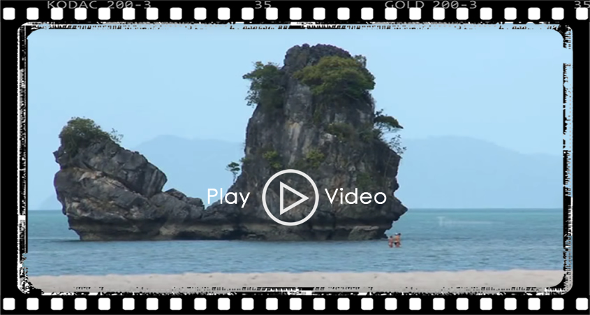
Kilim Karst Geoforest Park

Situated on the North-East of the Langkawi Island in the area around the Kilim River and its estuary, the terrain here is predominantly limestone (karst). Millions of years of erosion have created a unique landscape of pinnacles, cliffs, caves and hills as well as the rich biotopes of the mudflats and the mangrove eco-systems.

Explore the Kilim Geoforest by boat in order to reach places inaccessible by land, or walk around and discover some of the unique geological features, including ancient fossil beds and stalactites. Here you can find plenty of marine life in the emerald green waters below as well as spot birds, including the islands famous eagles, up high.

Machinchang Cambrian Geoforest Park

The Machinchang mountain range in the north-western corner of Langkawi, and Gunung Raya, a granite mountain at the centre is renowned for their Cambrian (first geological period of the Paleozoic Era) rock formations.

The rock here is predominantly sedimentary sandstone and granite and forms a spectacular landscape that dominates the skyline. Machinchang is Malaysia’s oldest mountain range, and home to what is probably the most ancient rainforest on the planet. The oldest part of this Geopark is Teluk Datai. This is where the oldest grains of sand rest, its history displayed in the exposed surface of sandstone in the upper part and mudstone/shale in the lower part.

Dayang Bunting Marble Geoforest Park

South of Langkawi you will find the second largest island of the archipelago, Pulau Dayang Bunting. Dayang Bunting means Pregnant Maiden, a name given to this island due to the suggestive shape of the hills on this island.

Famous for the fresh water lake found nestled amongst hills of rugged forest, it is also known as Lake of the Pregnant Maiden. The lake originated as a massive limestone cave which collapsed. There you will also find the finest Permian marble formations in the world.

Kubang Badak BioGeoTrail

Nestled within its lush landscapes, Kubang Badak boasts a tapestry of rich biodiversity, cherished heritage, and vibrant culture. The Kubang Badak BioGeoTrail stands as a testament to this abundance, its natural resources vital to sustaining the local community. Here, expansive mangrove forests, a diverse river estuary, and a historic settlement converge to form Kubang Badak's unique ecosystem.

Gunung Raya Granite Geosite

This geosite, situated at the heart of Langkawi, encompasses the island's tallest peak, Gunung Raya, standing at 881 meters. Comprised of Triassic-era granite (220-200 million years ago), it played a significant role in Langkawi's geological history by uplifting the island.

This unique granite contains abundant dark minerals, notably tourmaline and minimal ilmenite. Weathering and erosion of the rock transport quartz and dark minerals via rivers, eventually creating black sand beaches like Pantai Pasir Hitam. Gunung Raya holds great geotourism potential and is currently under consideration as the fourth geoforest park in Langkawi.